National Hydrologic Intelligence

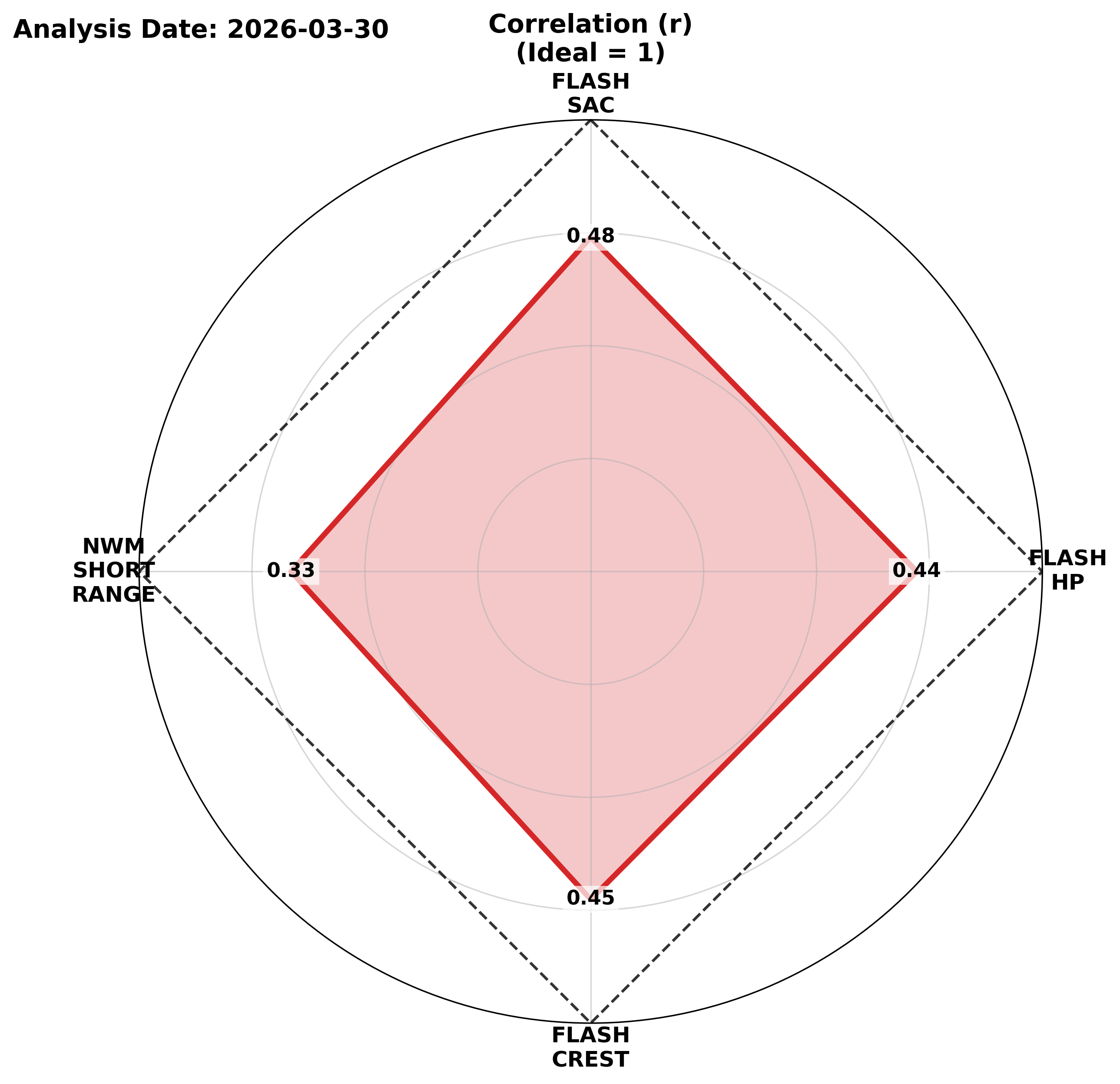
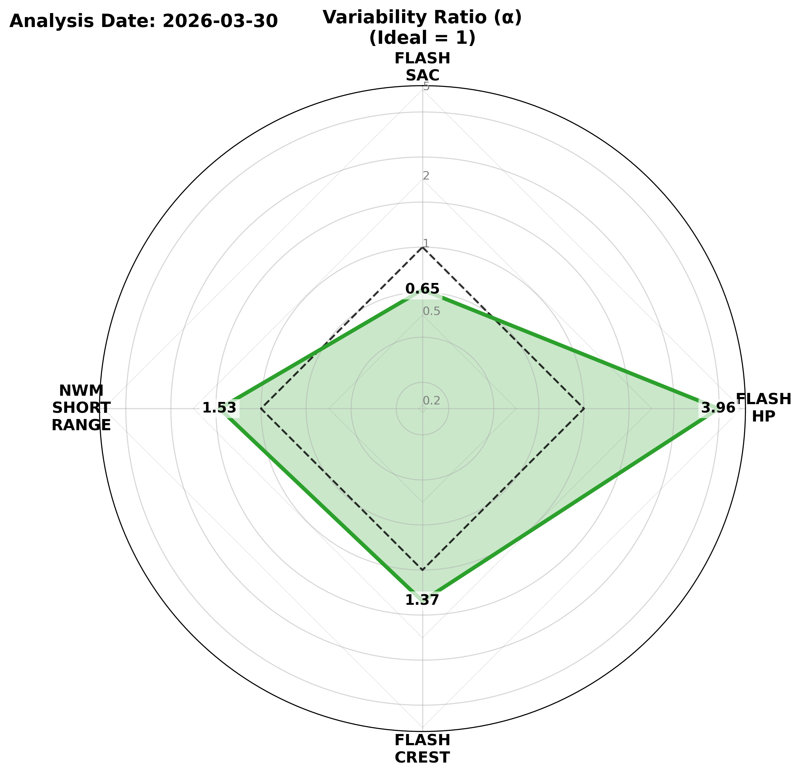
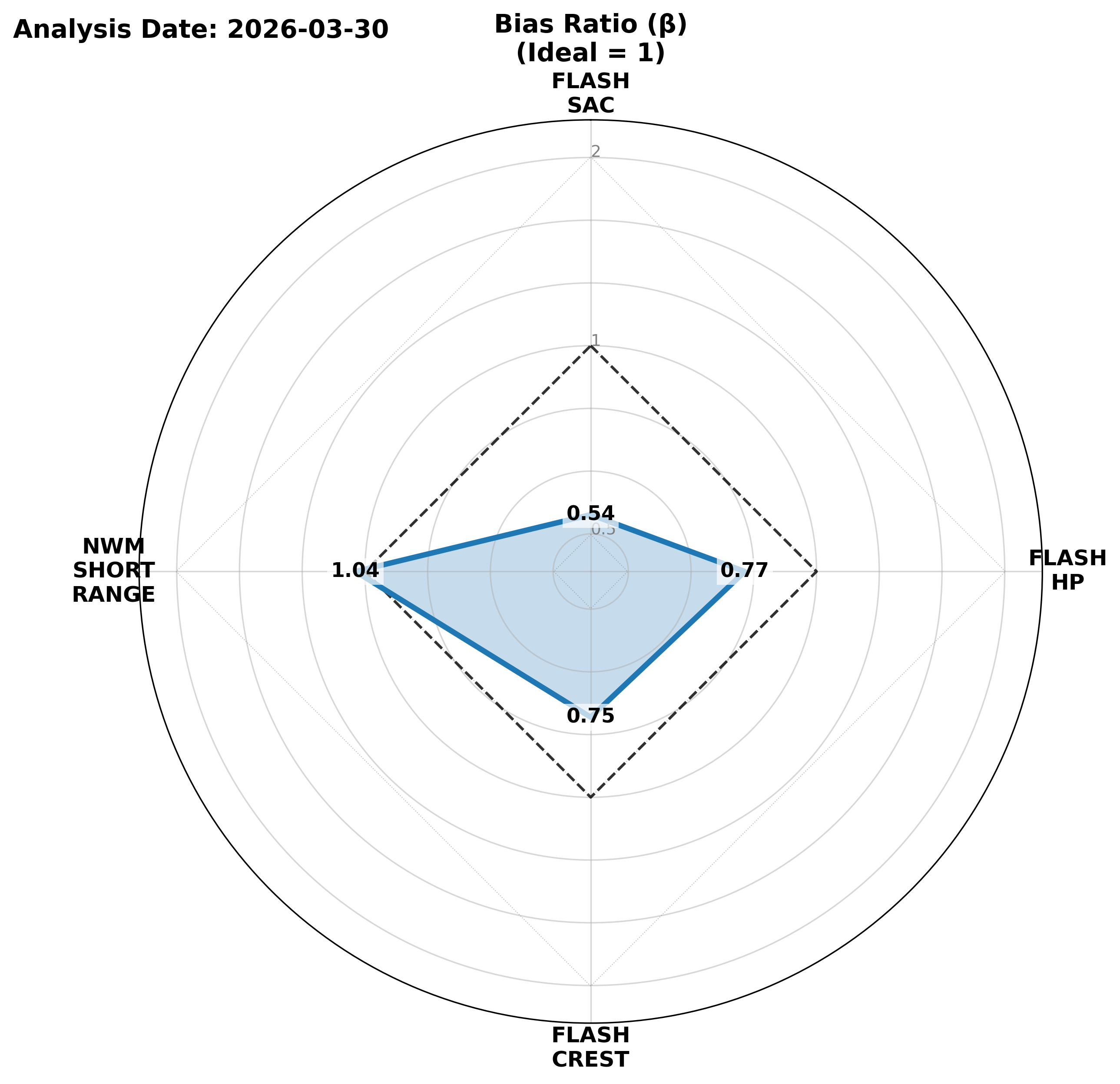
Real-time Visualization & Performance Metrics Powered by Lynker Spatial

Current Forecasts Overview
Update Frequency: Every 6 hours.
Displays the latest available flow predictions mapped to the National Hydrologic Geospatial Fabric.

Lynker Spatial’s flood propagation algorithm bridges the gap between macro-scale raster models and local-scale stream reaches.
By mapping GLOFAS and FLASH data to Hydrofabric, the system translates coarse-grid forecasts into precise flow estimates for the entire stream hierarchy (orders 1–10).

Note: AWI products are scaled by dividing the original forecasts by 1000 based on systematic bias found from Model Skill tab to correct the forecasts. There the values and scores are all scaled versions of the original forecasts.

GloFAS Discharge Forecast (Zoomed Area)

GloFAS Discharge Forecast (CONUS)

HP FLASH Discharge Hindcast (Zoomed Area)

HP FLASH Discharge Hindcast (CONUS)

CREST FLASH Discharge Hindcast (Zoomed Area)

CREST FLASH Discharge Hindcast (CONUS)

SAC FLASH Discharge Hindcast (Zoomed Area)

SAC FLASH Discharge Hindcast (CONUS)

AWI Short Range Discharge Forecast (Zoomed Area)

AWI Short Range Discharge Forecast (CONUS)

AWI Analysis Discharge Forecast (Zoomed Area)

AWI Analysis Discharge Forecast (CONUS)

NWM Short Range Forecast (Zoomed Area)

NWM Short Range Forecast (CONUS)

NWM Analysis (Zoomed Area)

NWM Analysis (CONUS)

Evaluation Methodology (Single Issuance Performance)
This section evaluates the accuracy of a single, recently completed forecast run. Rather than stitching together continuous hindcasts, the system retrieves a specific past forecast (e.g., the NWM forecast issued 18 hours ago, or the GloFAS forecast issued 10 days ago) and compares its predictions against the observations that actually occurred.
Update Frequency: Every 6 hours (Driven automatically following the latest model issuances).

Note: AWI products are scaled by dividing the original forecasts by 1000 based on systematic bias found from Model Skill tab to correct the forecasts. There the values and scores are all scaled versions of the original forecasts.
  • Spatial Error (MAE): Displays the aggregate Mean Absolute Error at each specific stream gauge over the lifespan of that single forecast run.
  • Obs vs Sim Scatter (CONUS): Pools all predictions from that single forecast run across all CONUS gauges into one distribution to identify systematic biases.
  • Lead Time Performance: Breaks down that exact same forecast run by lead-time interval, illustrating how the model's error degraded as it attempted to predict further into the future.
GloFAS Discharge Forecast

Spatial Error (MAE)

Mean Absolute Error (cms) computed point-by-point.

Obs vs Sim (CONUS)

Log-Log Scatter of all pooled prediction pairs.

Lead Time Performance

RMSE & VE pooled across all gauges per lead-time step.
HP FLASH Discharge Hindcast

Spatial Error (MAE)

Mean Absolute Error (cms) computed point-by-point.

Obs vs Sim (CONUS)

Log-Log Scatter of all pooled prediction pairs.
CREST FLASH Discharge Hindcast

Spatial Error (MAE)

Mean Absolute Error (cms) computed point-by-point.

Obs vs Sim (CONUS)

Log-Log Scatter of all pooled prediction pairs.
SAC FLASH Discharge Hindcast

Spatial Error (MAE)

Mean Absolute Error (cms) computed point-by-point.

Obs vs Sim (CONUS)

Log-Log Scatter of all pooled prediction pairs.
AWI Short Range Discharge Forecast

Spatial Error (MAE)

Mean Absolute Error (cms) computed point-by-point.

Obs vs Sim (CONUS)

Log-Log Scatter of all pooled prediction pairs.

Lead Time Performance

RMSE & VE pooled across all gauges per lead-time step.
AWI Analysis Discharge Forecast

Spatial Error (MAE)

Mean Absolute Error (cms) computed point-by-point.

Obs vs Sim (CONUS)

Log-Log Scatter of all pooled prediction pairs.
NWM Short Range Forecast

Spatial Error (MAE)

Mean Absolute Error (cms) computed point-by-point.

Obs vs Sim (CONUS)

Log-Log Scatter of all pooled prediction pairs.

Lead Time Performance

RMSE & VE pooled across all gauges per lead-time step.
NWM Analysis

Spatial Error (MAE)

Mean Absolute Error (cms) computed point-by-point.

Obs vs Sim (CONUS)

Log-Log Scatter of all pooled prediction pairs.

Lead Time Performance

RMSE & VE pooled across all gauges per lead-time step.
Regional Best-Performer Dashboard
Cross-Model Comparison Methodology (Weekly Continuous Track)
Unlike the Model Skill tab, this section evaluates a continuous trailing 7-day track of the previous week. It pits the stitched hourly/daily hindcasts of all models against each other over the exact same historical window, computing performance point by point to eliminate spatial bias.
Update Frequency: Once Daily. Pipeline executes every day to compile the prior 7 days of hydrographs. Pipeline executes after the full completion of the previous calendar day.

Note: AWI products are scaled by dividing the original forecasts by 1000 based on systematic bias found from Model Skill tab to correct the forecasts. There the values and scores are all scaled versions of the original forecasts.
  • Temporal & Spatial Aggregation:Observations and models are strictly aligned and grouped to calculate statistical metrics independently at every single stream gauge. To rank a region, the median performance of all valid gauges inside that polygon (VPU or HUC8) is presented. The model yielding the highest median statistical skill claims the region. Map tooltips reveal the number of valid gauges driving each region's score.
  • Scientific Note: Because daily aggregation naturally smooths out sub-daily timing errors, daily models (like GloFAS) may exhibit inherently higher baseline unitless scores (such as KGE or NSE) compared to hourly models that are strictly penalized for minor phase shifts.
Best Model
glofas
nwm_short_range
awi_short_range
flash_sac
flash_hp
flash_crest
CONUS Performance Components (KGE Decomposition)
KGE Decomposition Metrics Explained
This section breaks down the overall Kling-Gupta Efficiency (KGE) score into its three fundamental components, helping identify exactly where and why a model might be struggling:
  • Correlation (r): Matches hydrograph timing/shape. Ideal=1. Evaluates if the forecast hydrograph rises and falls in sync with observations.
  • Variability (α): Ratio of standard deviations. Ideal=1. Evaluates if the model correctly captures dispersion and extremes. >1 is too flashy; <1 is too muted.
  • Volume Bias (β): Ratio of overall means. Ideal=1. Evaluates systematic volume issues. >1 indicates wet bias; <1 indicates dry bias.

Correlation (r) ?

Matches hydrograph timing/shape. Ideal=1.

Variability (α) ?

Ratio of standard deviations. Ideal=1.

Volume Bias (β) ?

Ratio of overall means. Ideal=1.

Data Access & REST API

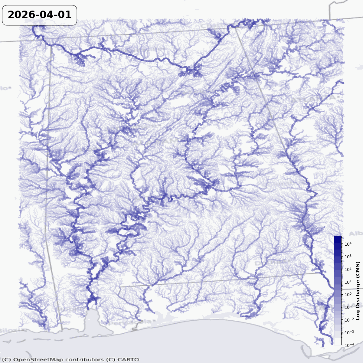
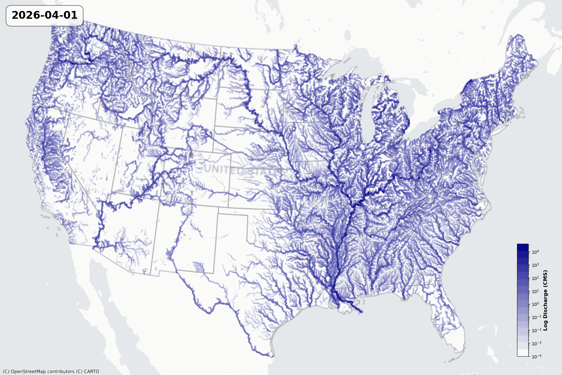
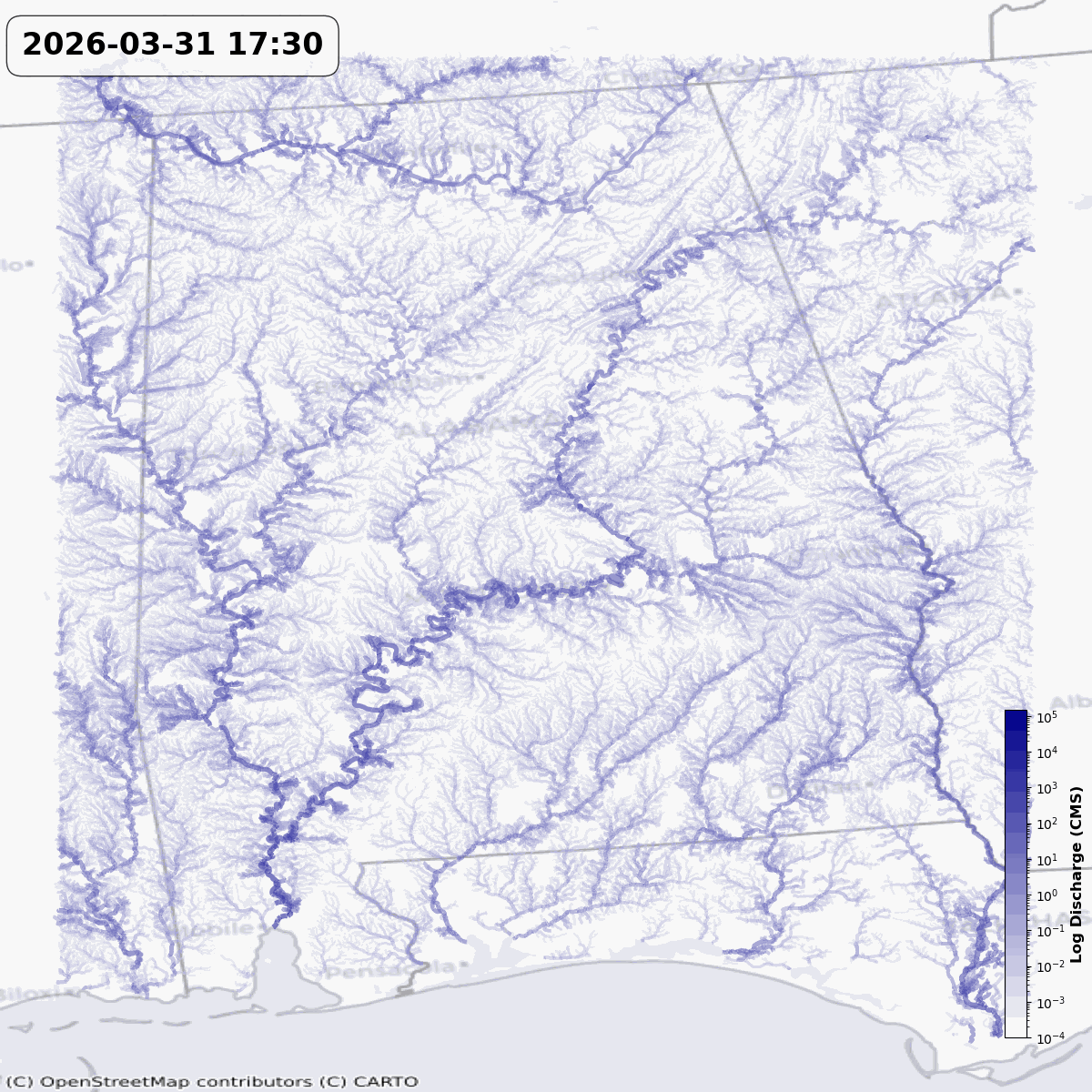
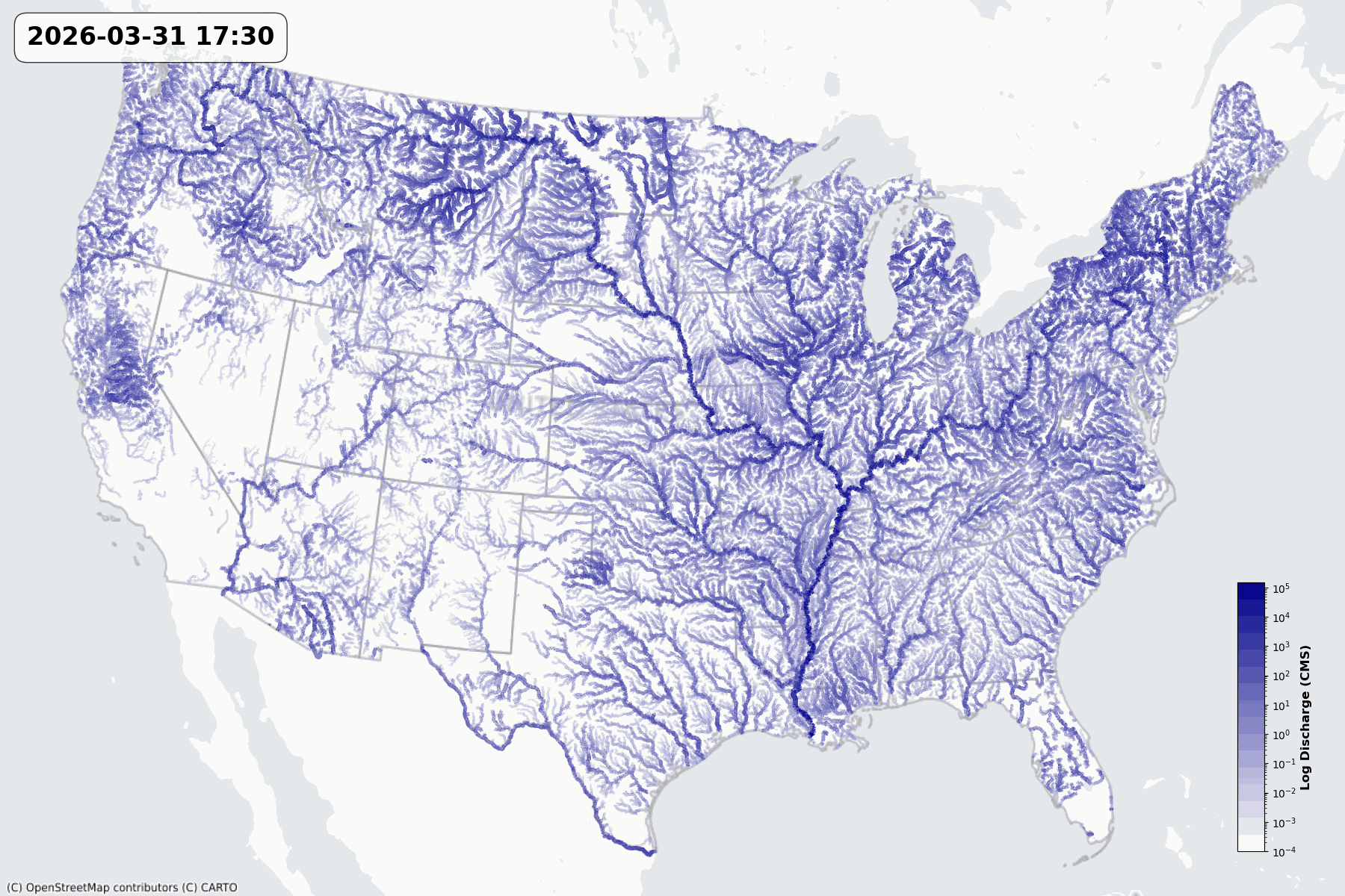
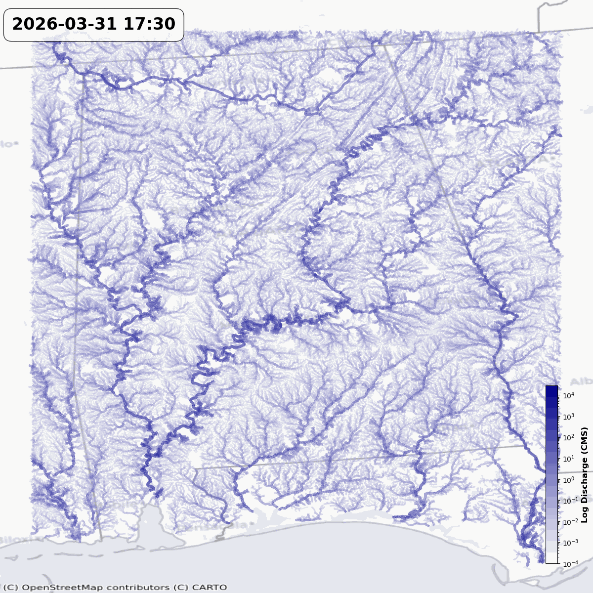
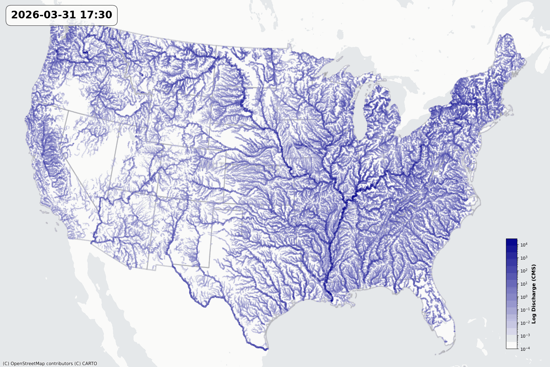
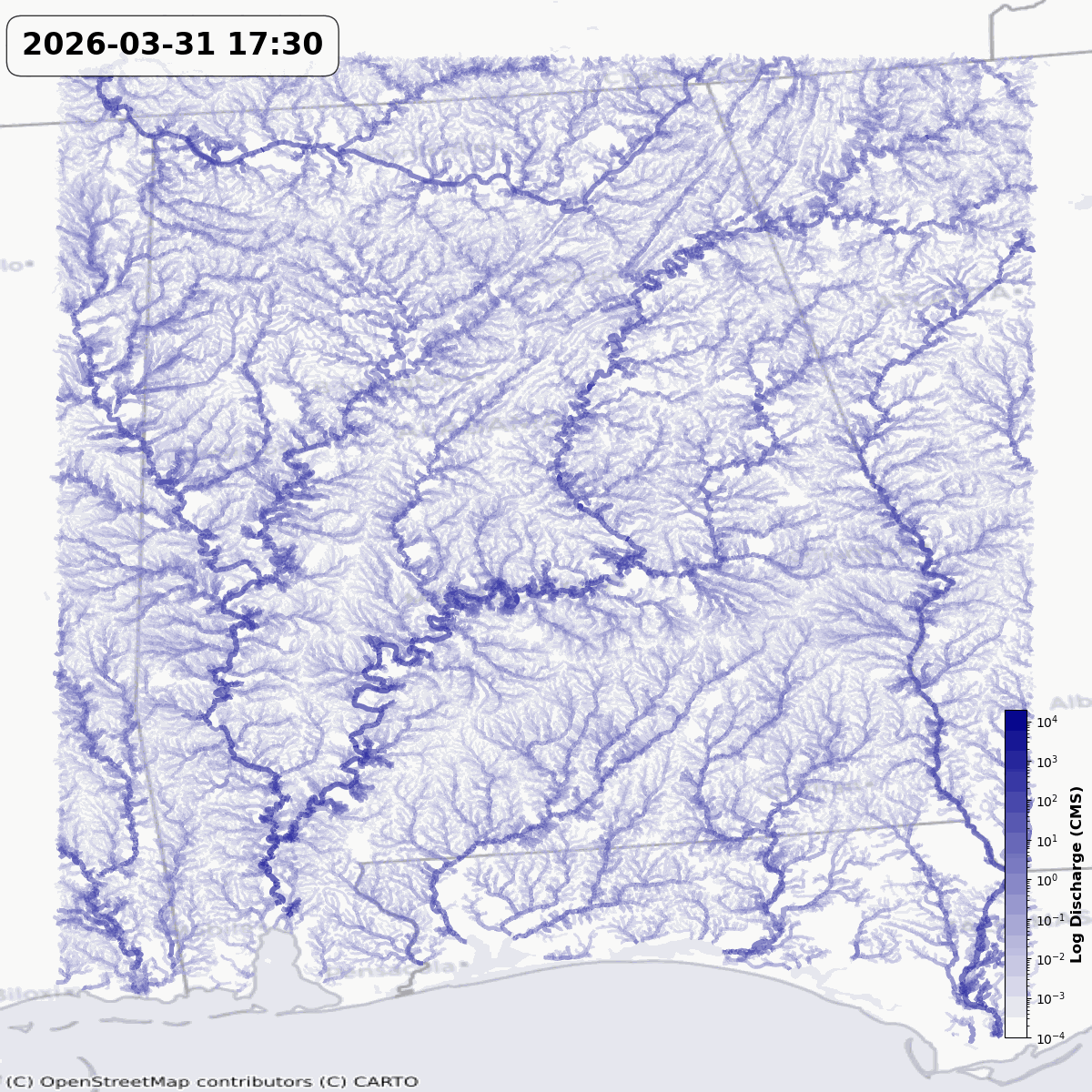
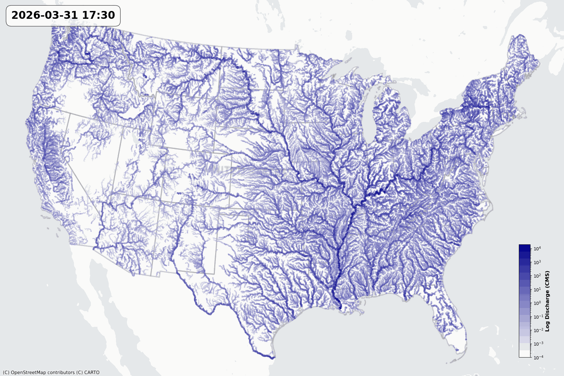
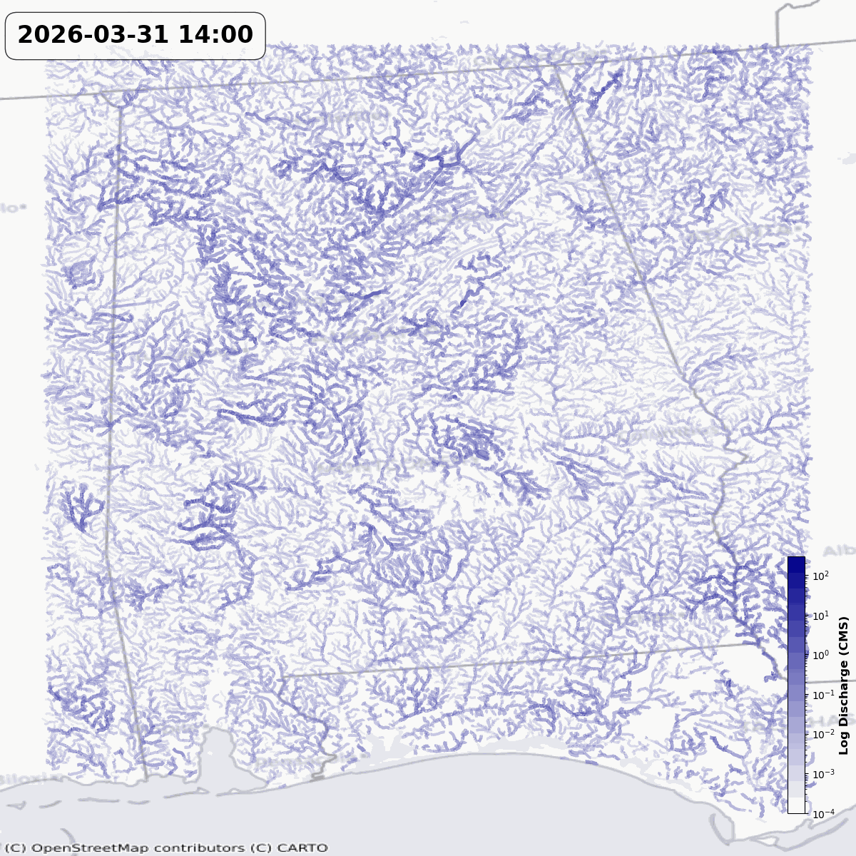
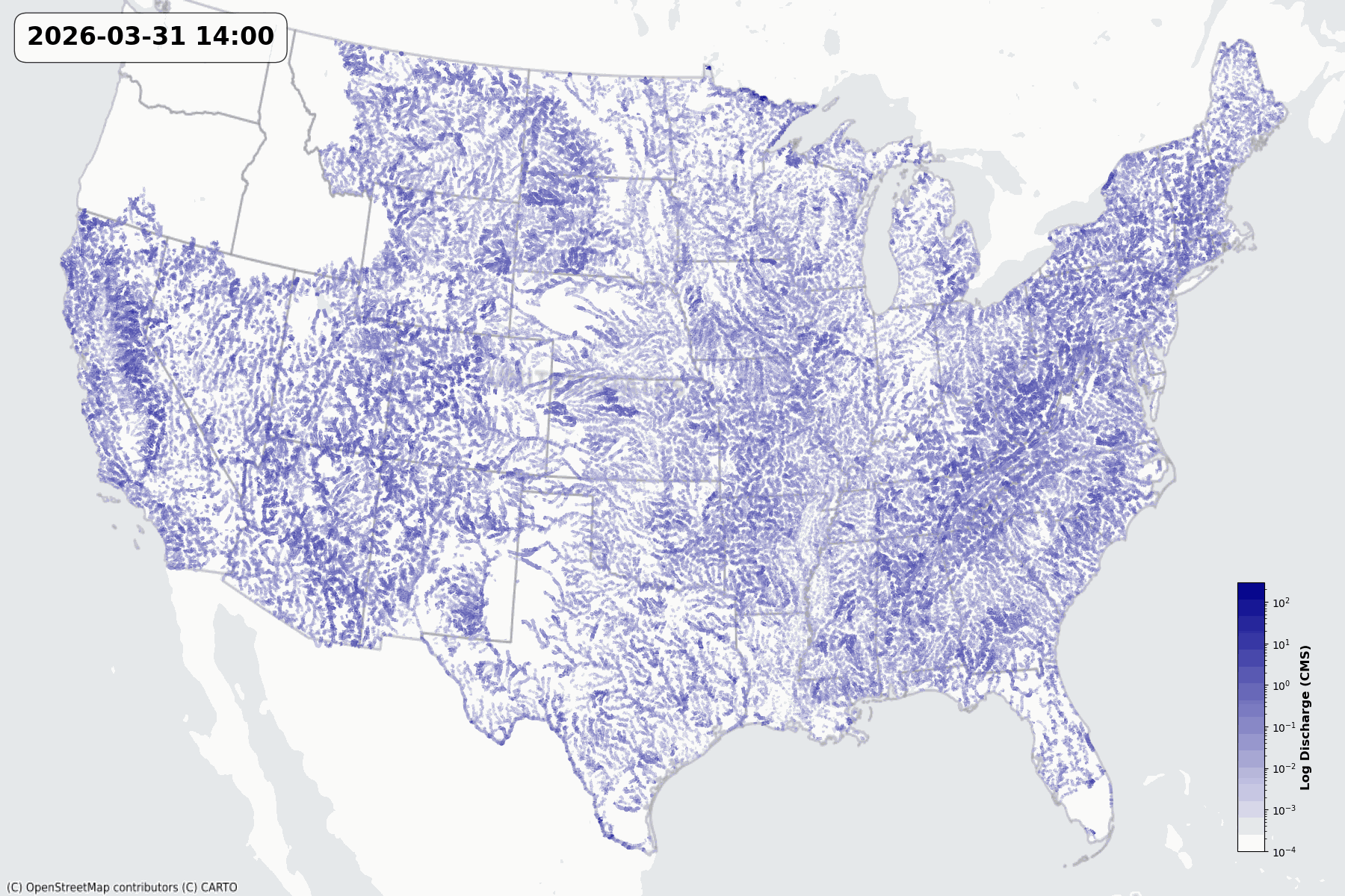
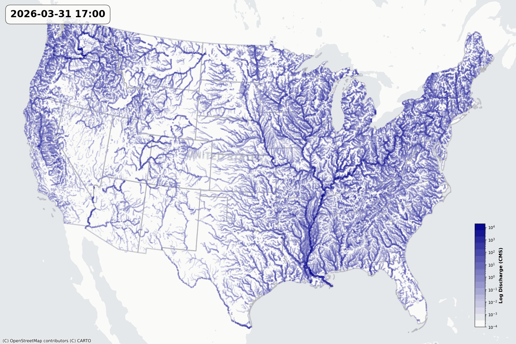
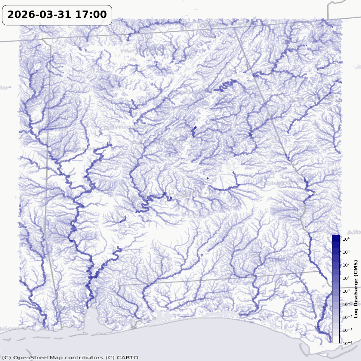
Programmatically access real time hydrologic time series data across all available model products. Integrate either the raw model outputs or their flow‑propagated counterparts to achieve hyper‑resolution, localized stream reach predictions directly within your applications, web maps, and custom workflows.

Explore API Documentation

Python: flowfabricpy

The Python access to the FlowFabric API. One-time authentication, fast, memory-efficient Arrow data transfer.
View flowfabric-py Docs
# Install from GitHub:
pip install git+https://github.com/lynker-spatial/flowfabric-py#egg=flowfabricpy

from flowfabricpy import *

# Query streamflow forecast
tbl = flowfabric_streamflow_query(
    dataset_id = "nws_owp_nwm_analysis",
    feature_ids = ["101", "1001"],
    issue_time = "latest"
)
print(tbl)

R: flowfabricr

The R client for the FlowFabric API. One-time authentication, fast, memory-efficient Arrow data transfer.
View flowfabric-r Docs
# Install from GitHub:
devtools::install_github('lynker-spatial/flowfabric-r')

library(flowfabricr)

# Query streamflow forecast
tbl <- flowfabric_streamflow_query(
    dataset_id = "nws_owp_nwm_analysis",
    feature_ids = c("101", "1001"),
    issue_time = "latest"
)
head(tbl)